

On August 11, 2025, Tropical Storm Erin officially formed in the eastern Atlantic, just west of the Cabo Verde Islands. As the fifth named storm of the 2025 Atlantic hurricane season, Erin is drawing attention from meteorologists and coastal residents alike due to its potential for rapid intensification. In this post, you’ll learn how Erin has developed, its projected track, and what to keep in mind if you’re in its possible path.
1. How Erin Formed and Its Current Status
- The National Hurricane Center reports that Erin emerged from a well-defined tropical wave near Cabo Verde around the morning of August 11, gaining strength quickly into a tropical storm (CBS News).
- It currently carries sustained winds of about 45 mph and is cruising west at roughly 20 mph (AP News).
2. Forecasts: Intensification & Projected Path
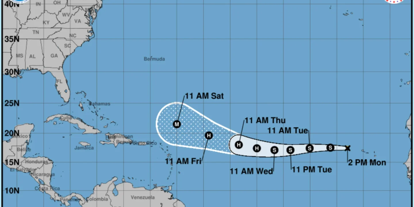
- Forecasters anticipate that Erin will likely become the Atlantic’s first hurricane of 2025, with hurricane strength expected by Wednesday, August 13, and possibly evolving into a major hurricane by this weekend (Yahoo News).
- Most model projections suggest Erin will steer generally westward through mid-week before gradually curving north or north-northwest by the weekend—keeping it off the U.S. East Coast for now (Weather.com).
3. Early Impacts in Cabo Verde
Erin’s onset has already had tragic effects: heavy rainfall in Cabo Verde, particularly on São Vicente island, has resulted in at least six deaths, including four children. The government declared states of emergency on São Vicente and Santo Antão due to flooding and infrastructure damage (Weather.com).
4. Outlook & Preparedness: What Coastal Areas Should Do
While Erin currently poses no immediate threat to the U.S., the forecast steepens the need for vigilance:
- The National Hurricane Center continues to monitor Erin carefully as it could threaten the Leeward Islands, the Bahamas, or the eastern U.S. depending on its track (AP News).
- A marine heat wave in the Atlantic is fueling stronger possible intensification, increasing uncertainty (Washington Post).
- Authorities in vulnerable regions—from the Caribbean to the U.S. Southeast—are advised to prepare emergency plans, stock up on essentials, and stay updated via official channels (Times of India).
Conclusion
Tropical Storm Erin’s rapid formation and forecasted growth make it a storm to watch. From its devastating start near Cabo Verde to its potential to become the season’s first hurricane, Erin highlights the power and unpredictability of Atlantic storms. While U.S. impacts remain unlikely right now, coastal residents and island communities are wise to stay alert. Keep an eye on official advisories, have your emergency kit ready, and stay informed.
Call to Action: Bookmark trusted weather sources like the National Hurricane Center and your local weather service, and check in daily as Erin’s path and strength evolve.